12 Gulf Of Mannar Facts You Might Not Know
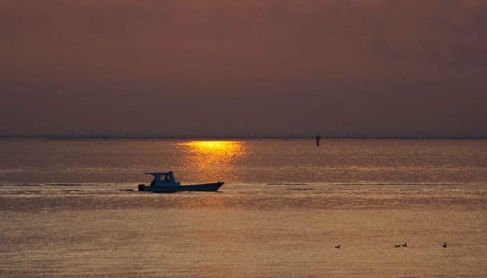
The Gulf of Mannar is an expansive shallow bay, a part of the larger Laccadive Sea in the Indian Ocean. It lies between the southeastern tip of India and the western shore of Sri Lanka in the Coromandel Coast region.
It comprises around 21 islands and an array of marine flora and fauna. The Gulf of Mannar has an average water depth of 5.8 metres, yet it is known as one of the richest areas of biodiversity in the world.
The Government of India has taken many steps to preserve this region, which has been recognised as a biosphere reserve and which supports the livelihood of many fishing and other communities living along its coasts.
Let’s explore 10 interesting facts about the Gulf of Mannar in this article.
1. Began taking shape in the late Cretaceous Period- 100 to 66 million years ago
The Gulf of Mannar was formed by complex geological and oceanographic processes over millions of years. The primary process leading to its formation was tectonic activity.
The Indian subcontinent and the Island of Sri Lanka are part of the Indian Plate that has been gradually drifting northwards towards the Eurasian Plate. When these plates collided, the Western Ghats mountain range was formed along India’s western coast, and the land was uplifted.
Rivers eroded the terrain and deposited sediment near the coast, creating coastal plains, which then formed barrier islands and sandbars.
These geographical features functioned as natural barriers, separating the open waters from the shallow and enclosed waters of the emerging Gulf of Mannar.
Monsoon winds and ocean currents transported sediments along the coast and led to the formation of islands within the gulf.
2. An important maritime trade route since ancient times
The Gulf of Mannar has been a major route for maritime trade and cross-cultural exchange since time immemorial. It finds mention in historical texts and manuscript records from different periods belonging to Ancient India, Ancient Greece, and also records of Arabs and European Accounts too.
For instance, ancient Indian texts like Ramayana and Mahabharata dating back to 2500-1500 BCE refer to the Gulf of Mannar and its importance in maritime trade.
Additionally, Greek and Roman geographers and traders like Ptolemy and Pliny the Elder wrote about the Gulf and its importance as a maritime hub.
3. Gulf of Mannar Became A Protected National Park in 1986
The Government of India recognised the need to conserve the ecology of the beautiful Gulf of Mannar and decided to preserve it by declaring it a Protected National Park in 1986, called the Gulf of Mannar National Park.
Hence, in 1986, a group of 21 islets situated off the coast of Tamil Nadu was declared the Gulf of Mannar National Park.
In 1989, three years later, the Indian Government declared the Park and its ten km buffer zone as a Biosphere Reserve, which became the first Biosphere Reserve in India.
This step was necessary as the Gulf of Mannar was being exploited by immoral fishing practices introducing harmful invasive species that were wreaking havoc on the endemic ones, accompanied by overfishing.
Also, the coral reefs suffered the most and have been revamped in the last 2 decades due to government initiatives, including building artificial reefs and efforts to remove the parasitic foreign marine life.
4. Surrounded By Rameswaram Island, Adam’s Bridge And Mannar Island
Pamban Island, or Rameswaram Island, lies between India and Sri Lanka on the Ram Setu archipelago. It is the biggest island in the Indian State of Tamil Nadu in terms of area and is one of the most sacred religious sites for Hindus. The Ramanthawamy Temple is quite famous and lies at the centre of the island.
The Adam’s Bridge, also known as Rama’s Bridge or Rama Setu, is a chain of low islands and reefs made of natural limestone. This structure separates the Gulf of Mannar from Palka Bay, which is situated to the north between India and Sri Lanka.
Geological evidence suggests that the Adam’s Bridge once formed a land connection between India and Sri Lanka.
Mannar Island is situated off the northwestern coast of Sri Lanka and is connected to the main island by a causeway and Mannar Bridge. It stretches 130 square kilometres and is covered with sand and vegetation.
5. Several rivers flow into the Gulf of Mannar
The Gulf of Mannar is 80 to 170 miles or 130 to 275 km wide and 100 miles or 160 km long.
It is fed by many rivers, like the estuaries of Thamirabarani and Vaippar Rivers from South India and the Malvathu River of Sri Lanka.
The Thamirabarani or Tamraparni is a perennial river originating from Agastyarkoodam peak, Pothigai hills of the Western Ghats. It flows through Tamil Nadu and drains into the Gulf of Mannar.
It was known as the Tamraparni River in the pre-classical age, whereas it was called Porunai in old Tamil. From its source, till it meets the sea, it is 128 km long and is the only perennial river in the Indian State of Tamil Nadu. It flows to the north initially and then towards the eastern side.
Vaippar River originates from Varusanadu Hills surrounding the state of Kerela. It flows from Sivagiri through Virughnagar and Tuticorin and flows into the Gulf of Mannar near Sippikulam.
It is 130 km or 81 miles long and has a drainage basin spanning 5288 sq km or 2042 sq miles.
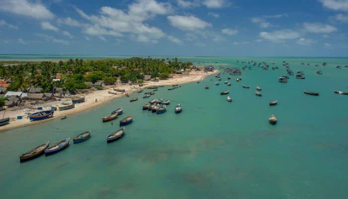
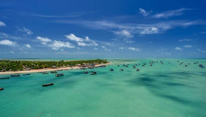
6. Gulf of Mannar is a biodiversity hotspot
The Gulf of Mannar harbours more than 3600 species of plant and animal life and is one of the most ecologically diverse coastal regions in Asia. It is also home to 117 hard coral species, sea turtles, sharks, dugongs and dolphins.
Near the region lie 47 villages with 50,000 people, which depend on the resources of the gulf for their livelihood. Given this fact, the overharvesting of marine species is an issue.
Over the years, fish populations in the gulf waters have declined, along with a reduction in the numbers of pearl oysters, gorgonian coral, and acorn worms.
Other threats include destructive fishing methods, pollution, coral mining etc. This has taken some species that once thrived in the gulf to the category of endangered species. Dugongs, dolphins, whales, sea horses, and sea cucumbers are some of them.
The swamp close to Kodandaraman Temple provides shelter to a flock of 10,000 flamingoes each year from December to March, along with many other species of waders and wetland birds.
7. Gulf of Mannar Biosphere Reserve Spans 10,500 km2 of ocean and 21 islands
The Biosphere Reserve includes 10,500 sq km of ocean, 21 islands and the adjoining coastline.
The topography varies, and there are beaches, tropical dry broadleaf forests, and estuaries. Marine Environments include seaweed communities, seagrass, salt marshes, mangroves and coral reefs.

In 2019, The National Centre for Coastal Research, which has a research station in the Gulf of Mannar, discovered a pattern of bleaching in the coral reefs in Mandapam, Palk Bay and Kilakarai. They found bleaching occurred when the temperature rose between 32 °C and 36 °C.
8. Gulf of Mannar is known for its pearl banks for thousands of years
The Gulf of Mannar has been famous for its pearl banks of the Pinctada Radiata and Pictada Fucata since ancient times. Interestingly, Pliny the Elder wrote about the pearl fishery in the gulf as being one of the most productive in the whole world during his time.
There are about 80 pearl banks in this region which became a rich source of revenue for kingdoms like Cholas and Pandyas.
However, Pearl fishing was gradually discontinued in 1961 as the resources waned due to overexploitation.
The Pearl Banks stretch from Mannar Island, off the northwestern end of Sri Lanka, south to Chilaw. Their depths range from 5 to 15 fathoms.
9. Main seaports on the Gulf of Mannar are Tuticorin and Colombo
Tuticorin Port is situated on the southeastern coast of India in Tamil Nadu on the western side of the Gulf of Mannar. It is an artificial port facility, said to be the third biggest container terminal in the country.
The port comprises two operational areas, namely Zone 1 and Zone 2. The former contains new port facilities, while the latter is a small anchorage port.
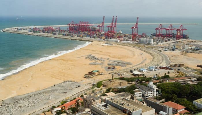
It has 2 breakwaters that create an artificial harbour.
It handles exports of salt, ilmenite sand, tea, cotton piece goods, sugar, molasses, coffee, stones, cotton yarn etc. Imports include coal, fertilisers, sugar, grains, peas, pulp wood, naphtha, raw cashew, LPG, furnace oil, iron scrap, etc.
Approximately 25, 730,000 tonnes of cargo and 467,700 TEU is handled annually at the port.
The Port of Colombo lies on the western coast of Sri Lanka and is the principal port of the country. It covers 201.5 ha and is enclosed by breakwaters with two entrances.
It is a major container transhipment facility which is presently undergoing extensive container berth expansion. The port has four container terminals and a conventional berth.
Colombo Port handles 30,900,000 tonnes of cargo, 4,100,000 TEU and 4,200 vessels annually.
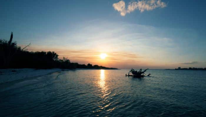
10. Gulf of Mannar region is a famous tourist destination
The Gulf is popular for snorkelling, and people visit the region since it is one of the most diverse marine locations with breathtaking views.
On land, there are many places one can visit, such as the Ramanhaswamy Temple, a shrine dedicated to the God Shiva, situated on the Ramanathaswamy island in the Gulf of Mannar.
It is also a historical place since it was built 1000 years ago and has a 1000 pillared hall, making it one of India’s most sacred and historical Hindu worship sites.
For a more relaxed getaway, one can visit the Danushkodi beach, lie amidst its white sand shores, and swim in its crystal clear waters. One can walk through the dunes of Adam’s Bridge, explore the region, meet local communities, and enjoy fresh and delicious seafood.
11. Experiences a tropical climate
One of the reasons why the Gulf of Mannar is popular among tourists is because of its stunning blue waters, a favourable tropical climate perfect for sunbathing and relaxing, gentle winds and clear skies.
This natural paradise is neither too hot nor too cold, with average temperatures between 24-32 degrees Celsius.
However, it does experience heavy rainfall during monsoon months which lasts from June to September, as it is affected by both southwest and northeast monsoons.
12. Threatened by human activities like habitat destruction
The Gulf of Mannar suffers from threats to its ecology, including habitat destruction, over-harvesting of marine resources, marine pollution, and localised land-based pollution.
Among these, habitat destruction of corals, seagrass and mangroves is the most serious threat to the Gulf of Mannar. Coral mining was stopped in 2005. However, seagrass beds were damaged due to inappropriate bottom trawling practices.
You might also like to read-
- 10 Denmark Strait Facts You Might Not Know
- 10 Gulf Of Alaska Facts You Might Not Know
- 10 Baffin Bay Facts You Should Not Miss Out
- 10 Buildings In The World Inspired By The Sails Of A Ship
- 10 Longest Ships In The World
Disclaimer: The authors’ views expressed in this article do not necessarily reflect the views of Marine Insight. Data and charts, if used in the article, have been sourced from available information and have not been authenticated by any statutory authority. The author and Marine Insight do not claim it to be accurate nor accept any responsibility for the same. The views constitute only the opinions and do not constitute any guidelines or recommendations on any course of action to be followed by the reader.
The article or images cannot be reproduced, copied, shared or used in any form without the permission of the author and Marine Insight.